
Murphys, CA
About Our Neighborhood
Downtown Murphys is a working Gold Rush town, not a recreation of one. The town was founded in 1848 by brothers John and Daniel Murphy, and the stone buildings and wooden boardwalks lining Main Street today are the same ones that sheltered miners, merchants, and travelers more than 170 years ago. Main Street is walkable start to finish — wine tasting rooms, boutique shops, art galleries, and restaurants sit side by side in buildings that once served as apothecaries, mercantiles, and saloons.
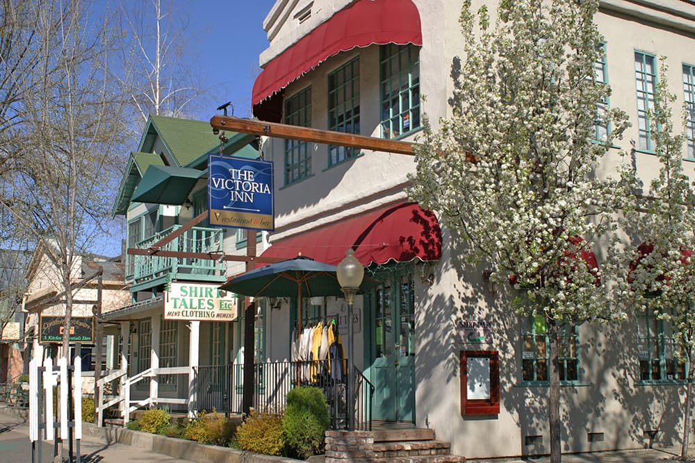
It's a compact place. You can park once and walk to nearly everything downtown has to offer, and the pace favors lingering — a long lunch on a patio, an afternoon moving room to room between tasting rooms, an evening stroll before dinner. Murphys Community Park, along the creek at the edge of downtown, gives the town a quieter green space just steps from Main Street.
Getting to Murphys, CA
Murphys sits along Highway 4 in the Sierra Nevada foothills of Calaveras County, about an hour east of Stockton and just under two hours from the Sacramento region.
From the West (San Francisco Bay Area / Stockton)
Take I-580 to I-205 to Highway 99 North, then exit onto Highway 4 East at Stockton, following signs toward Angels Camp. Highway 4 carries you directly into Murphys, passing through Copperopolis and Angels Camp along the way — plan for about 2.5 to 3 hours from San Francisco, or roughly 75 minutes from Stockton.
From Sacramento
Head south on Highway 99, then pick up Highway 4 East at Stockton (or come down through Jackson via Highway 49 if you prefer the scenic Gold Country route). The drive is about 88 miles and takes 1 hour 40 minutes to 1 hour 50 minutes.
From the closest major highway junctions
Murphys is most easily reached via Highway 4, which connects to Highway 99 near Stockton and to Highway 49 (the historic Gold Country corridor) near Angels Camp, just 15 minutes from town. If you're coming from Yosemite or the Highway 395 corridor to the east, Highway 4 also crosses the Sierra via Ebbetts Pass — a stunning but seasonal route that typically closes with the first heavy snowfall each winter.
From Sonora / Highway 108
It's a short 30-minute hop north on local roads connecting Highway 108 to Highway 4.
How Far is Murphys From ...
Major Attractions
Calaveras Big Trees State Park (giant sequoia groves) — 18 miles / about 30 minutes
Mercer Caverns — 11 miles / about 17 minutes
Moaning Caverns Adventure Park — 14 miles / about 20 minutes
Columbia State Historic Park (living Gold Rush town) — about 40 minutes
Yosemite National Park — 93 miles / about 2 hours 20 minutes
Major Event Spaces
Ironstone Vineyards Amphitheater (summer concert series, right in Murphys) — 8.5 miles / about 14 minutes
Murphys Creek Theatre — 8 miles / about 10 minutes
For larger conference or convention facilities, the nearest full-scale venues are in Stockton (about 61 miles) and Sacramento (about 88 miles)
Closest Major City
Stockton — 61 miles / about 1 hour 15 minutes
Sacramento — 88 miles / about 1 hour 40–50 minutes
Distance at a Glance
| FROM | DISTANCE | DRIVE TIME |
|---|---|---|
| Angels Camp, CA | 9 miles | ~13 minutes |
| Sonora, CA | 18 miles | ~30 minutes |
| Stockton, CA | 61 miles | ~1 hour 15 minutes |
| Modesto, CA | ~55 miles | ~1 hour 15 minutes |
| Sacramento, CA | 88 miles | ~1 hour 40–50 minutes |
| Yosemite National Park | 93 miles | ~2 hours 20 minutes |
| San Francisco, CA | 139 miles | ~2 hours 40 minutes–3 hours |
Drive times are estimates for typical, non-peak traffic conditions and can run longer on weekends during peak wine-country and holiday travel.
Travel FAQ
What's the closest airport to Murphys?
Stockton Metropolitan Airport (SCK) is the closest, followed by Sacramento International Airport (SMF), about 88 miles away. Most visitors flying in for a longer California trip connect through San Francisco or Sacramento and drive in from there.
Is Highway 4 open year-round?
The section of Highway 4 leading into Murphys from Stockton and Angels Camp is open year-round. The stretch east of Murphys over Ebbetts Pass is seasonal and typically closes with the first significant snowfall, reopening in late spring.
Do I need a car to get around Murphys?
Yes — there's no regular public transit into town. Once you're here, though, downtown Murphys is entirely walkable, and most lodging is within walking distance of Main Street.
How far is Murphys from Yosemite? Can I visit both on the same trip?
Murphys is about 93 miles (roughly 2 hours 20 minutes) from Yosemite National Park. Many visitors combine the two, using Murphys as a quieter, less crowded base for a day trip into the park.
Is there parking downtown?
Maybe.
What's the best route if I'm coming from the Bay Area?
Take I-580 East to I-205 to Highway 99 North, then Highway 4 East at Stockton. Plan for about 2.5 to 3 hours depending on traffic through the Central Valley.